OUR SERVICES
Data insights & design inspirations
from geospatial perspectives.
Our work at Cirito Concepts is influenced by Geo-spatial perspectives.
GIS value-adds data analyses though geographical theories and spatial insights such as by overlaying different maps to find patterns, associations, correlations and hotspots.
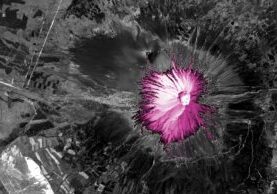
We are also advocating GIS images as artwork. GIS Art are aesthetic maps created by raster images, vector images or good old illustrations. They include street maps, satellite images, etc. The creative overlays of vector map features and the rendering of satellite images are artistic expressions, and we hope to further introduce this art form in Singapore.

- Creation of developer tools
- Data operations: digitising, formatting & geo-coding
- Geo-spatial analyses such as co-occurrences, hot spots, proximity

- Collection of satellite images, street maps, and other illustrations
- Customised raster and vector maps
GALLERY
Illustrated maps. Satellite images. Urban street maps.


